
Location intelligence applications turn the movement of assets, people and work-in-process into decisions that improve throughput, safety and service. Outdoors, GPS often provides enough context. Indoors, the useful question is more specific: where is this forklift, cart, tool, pallet, patient or technician right now, and what should the operation do about it?
Location intelligence solutions combine indoor positioning, IoT sensors, analytics and operational systems. Instead of reporting yesterday’s activity, they show the current state of a facility and help teams prevent delays before they become costly. RTLS provides the live position layer, while digital twins turn that data into an operational model that can be measured, simulated and improved.
For operations leaders, the value is practical: less time searching for equipment, fewer unnecessary forklift trips, earlier bottleneck detection, safer vehicle operations, and better decisions about layout, staffing and automation.
What Do We Mean by Location Intelligence?
Location intelligence uses where things are, where they have been and how they move to support better operational decisions. It combines facility maps, zones, routes and work areas with live signals from tags, sensors, vehicles and enterprise systems.
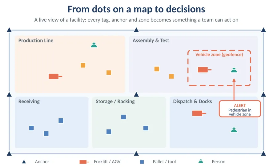
In practice, it answers questions such as: Which pallet is closest to the outbound dock? Which machine is waiting for a tool? Where is the nearest available forklift? The answer is not simply a dot on a map; it is an action, such as redirecting a vehicle, releasing a work order or alerting a supervisor.
Where do geospatial and location intelligence differ?
Geospatial intelligence usually focuses on geographic data: maps, coordinates, terrain, satellite imagery and large-scale spatial relationships. It supports logistics networks, site selection, route planning and outdoor asset visibility.
Location intelligence brings that spatial thinking indoors. It works at the scale of a production line, warehouse aisle, hospital wing or yard, using a building floorplan rather than latitude and longitude. Data may come from BLE tags, UWB anchors, RFID readers, Wi-Fi or vehicle telemetry.
Indoor operations need more than a map. They need context: which asset is involved, which process step it belongs to, whether it is moving or idle, and what a delay will cost if nobody intervenes.
Why does GPS fall short indoors?
GPS works well outdoors because satellite signals can reach a receiver directly. Indoors, roofs, steel structures, concrete walls and machinery weaken, reflect or block those signals. The result is poor accuracy, inconsistent coverage and little ability to distinguish one aisle, room or workstation from another.
Indoor location intelligence relies on purpose-built positioning. RTLS technologies use time difference of arrival, angle of arrival, time of flight or received signal strength to estimate position from signals received by fixed anchors or gateways. UWB can reach roughly 10–30 cm accuracy, while BLE commonly provides 1–5 m accuracy and suits cost-effective, large-scale tracking.
The right choice depends on the decision being supported. Zone-level visibility may be enough for inventory control, while collision avoidance, tool control or safety geofencing may require much finer positioning.
How Big Is the Location Intelligence Market Size, and Where Is It Heading?
The location intelligence market size is growing because organizations increasingly treat location as operational data rather than a mapping feature. Manufacturing, logistics, healthcare, retail, utilities and smart-city programs all use location data to improve efficiency, customer experience and risk management.
Public estimates vary because vendors define the category differently. Some include only mapping and geospatial analytics software; others include indoor positioning hardware, RTLS platforms, IoT sensors, digital twins, services and industry-specific applications. A headline number should therefore be treated as directional, not as a procurement benchmark.
The consistent direction is from static maps and periodic reports toward live operational visibility. The most valuable systems do not merely locate an asset; they connect location to workflow, inventory, maintenance, safety and planning systems.
Why do analyst estimates disagree?
Analyst estimates disagree because “location intelligence” is a broad label. A forecast may count geospatial analytics software, GIS platforms, location-based advertising, navigation services, indoor positioning infrastructure or enterprise asset tracking. Each has different buyers, sales cycles and growth drivers.
For an industrial buyer, the useful comparison is not the global market size. It is the addressable value inside the facility: search time, unnecessary travel, idle equipment, safety exposure, missed service levels and the cost of poor layout decisions.
What makes indoor positioning grow faster?
Indoor positioning grows because tags, anchors, gateways and edge devices have become more affordable, while wireless networks, cloud platforms and APIs make integration easier. BLE has widened adoption because it is relatively low cost, widely supported and suitable for continuous tracking of reusable assets.
Operations also face pressure to improve productivity without adding labor. Real-time visibility helps teams find assets faster, reduce empty travel and identify bottlenecks. LocaXion cites RTLS outcomes including 25–40% higher asset utilization, 15–30% productivity improvement and 70–90% reduction in search time, though results depend on use case and implementation quality.
Digital twins add another driver. By combining live location with a model of the facility, teams can test layout, staffing, automation and process changes before committing capital.
Where Are Location Intelligence Applications Already Working?
Location intelligence applications are most valuable where physical movement is central to performance. Manufacturing, warehousing, logistics and healthcare all depend on assets, people and materials being in the right place at the right time.
Maturity matters. A basic deployment provides live asset search. A more advanced deployment measures process flow and detects anomalies. The highest-maturity deployments use the same data to simulate alternative operating scenarios.
What happens on the factory floor?
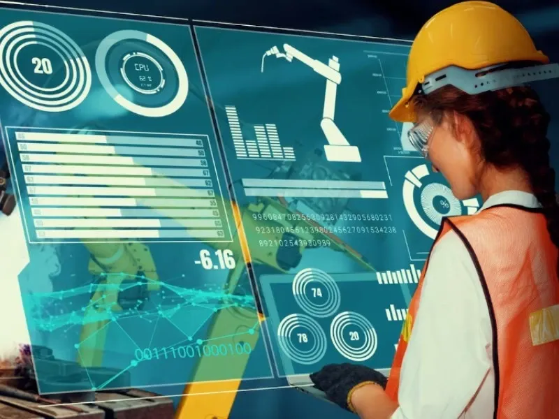
On a factory floor, location intelligence connects production execution with physical reality. Tags on tools, carts, containers, work-in-process and mobile equipment reveal where materials are waiting, which stations are blocked and which assets are unavailable.
If a line stops, the system can show whether the required test jig is missing, whether a sub-assembly is still elsewhere, or whether a certified operator is unavailable. That turns a vague “line down” alert into a specific, actionable diagnosis.
Location data also exposes hidden waste. LocaXion describes a digital twin that identifies that 40% of forklift and AGV travel consists of empty runs. Managers can then redesign routes, rebalance work, change staging locations or adjust vehicle deployment.
Safety is another major application. Geofences can alert operators when pedestrians enter vehicle zones, restrict access to hazardous areas, or trigger emergency mustering. LocaXion reports 68% fewer vehicle-pedestrian incidents and 67% faster emergency mustering in one harsh-industrial example.
Five steps, no jargon
- Capture: A tag, badge, vehicle device or sensor emits a signal, sometimes with temperature, shock, battery or motion data.
- Receive: Anchors, gateways or readers detect the signal. Their known positions provide reference points for estimating location.
- Calculate: The location engine processes timing, angle or signal strength to estimate position, often combining technologies in difficult environments.
- Add context: The platform links position to an asset record, work order, patient, shipment, maintenance schedule or safety zone.
- Act: The system displays information, sends an alert, updates an enterprise system or triggers a workflow—for example, assigning the nearest forklift or flagging a missing tool.
Where the digital twin comes in
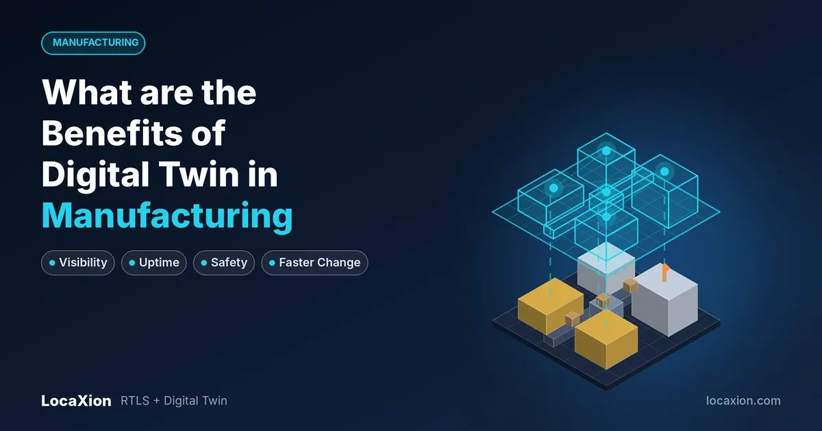
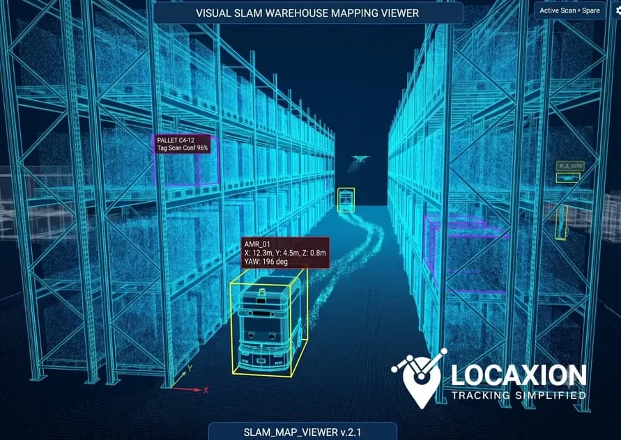
A digital twin is a virtual representation of a physical operation continuously updated with real-world data. In a location-intelligent digital twin, live RTLS data feeds a model of the facility, assets, people and processes.
This makes the twin more than a 3D visualization. Teams can see congestion, measure dwell time, identify idle assets and analyze movement patterns. They can also test “what-if” scenarios—such as adding a production cell, changing forklift routes or redesigning a warehouse layout—before making physical changes.
Traditional digital twins often rely on static assumptions or manual updates. RTLS-powered twins update with live spatial data, moving organizations from reactive reporting to proactive control.
LocaXion frames maturity in three levels: real-time visibility, measure and control, and planning and simulation. Visibility finds assets; measurement explains process performance; simulation tests improvements before implementation.
The Location Intelligence Tools and Products You’ll Run Into
Location intelligence tools range from simple asset-finder apps to enterprise platforms combining positioning, IoT, analytics and simulation. The important question is not which tool has the most features, but which layer solves the operational problem.
Products generally fall into positioning hardware, RTLS software, digital-twin platforms, IoT integration tools, analytics and visualization tools, and enterprise-system connectors. A complete solution may use components from several vendors, provided the data model and integration approach are sound.
What each layer does
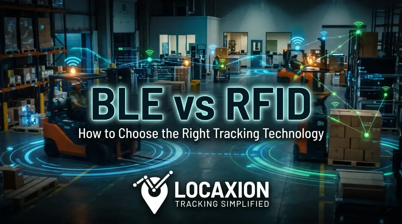
Positioning hardware includes tags, badges, anchors, gateways and readers. It determines what can be detected and how accurately. UWB suits high-precision applications, BLE suits cost-effective continuous tracking, Wi-Fi leverages existing infrastructure, and RFID suits high-volume checkpoint reads.
RTLS software calculates and manages location. It receives tag signals, estimates position, manages zones and geofences, and exposes location events to other systems.
Digital-twin platforms create the operational model. They combine floorplans, asset records, live location, sensor data and process rules into a shared view of the facility, while enabling simulation and scenario planning.
Analytics and integration tools connect location events to WMS, ERP, MES, maintenance and safety systems, turning them into alerts, KPIs and automated workflows. LocaXion highlights API-based integration with SAP, Oracle and Microsoft platforms.
How to avoid being locked in
Vendor lock-in is a risk when positioning hardware, location software and business applications are tightly coupled. If a vendor changes pricing, discontinues a tag or cannot support a new site, the organization may face an expensive rebuild.
Avoid it with an open, modular architecture. Keep the data model separate from the radio technology, use standard APIs, and ensure tags and infrastructure can be replaced without rewriting applications. LocaXion positions its platform as vendor-agnostic, connecting a mix of RTLS technologies across brands.
Start with a pilot in the most difficult part of the facility. Metal racking, liquids, machinery and dense radio environments affect performance, so a site survey and pilot should validate accuracy, update rate, battery life and integration before full rollout.
Frequently Asked Questions
What is location intelligence in simple terms?
It uses data about where assets, people and materials are located to support better operational decisions. It answers not only “where is it?” but also “what should we do next?”
How is location intelligence different from RTLS?
RTLS provides real-time positioning. Location intelligence is broader: it combines positioning with context, analytics, workflows and enterprise systems to support decisions.
Do location intelligence applications require UWB?
No. UWB suits high-precision needs such as tool control, safety zones or collision avoidance. BLE, Wi-Fi and RFID can be appropriate for zone tracking, inventory visibility or lower-cost asset tracking.
Can location intelligence work alongside WMS, ERP and MES?
Yes. Effective deployments integrate location events with existing systems rather than replacing them. APIs and middleware can send updates to WMS, ERP, MES and maintenance platforms.
What should organizations measure first?
Start with search time, asset utilization, empty vehicle travel, dock cycle time, safety incidents, work-in-process waiting time and on-time completion. Then measure improvement after deployment.
Conclusion
Location intelligence applications succeed when they turn real-time location data into a decision someone can act on. A dot on a map is not the outcome; redirected forklifts, located tools, safer vehicle routes, faster equipment retrieval and better layout decisions are.
For indoor operations, the strongest approach combines RTLS for live positioning, IoT and enterprise systems for context, and digital twins for analysis and simulation. This creates a path from visibility to control: know where assets and people are, understand why processes slow down, then test improvements before committing to them.
Organizations that begin with a clear operational problem, validate performance in real conditions and keep their architecture open are more likely to turn location intelligence into lasting operational advantage.