LocaXion

Field Guide Volume I, No. 001 2026

RTLS Field Guide  ·  Issue 001  ·  Spring 2026

A Comparative Study of Four Indoor-Location Systems

Forklift

Tracking.

How it actually works — and what it really costs, once the pilot is over and the invoice clears.

Subject

Indoor RTLS*.*

Technologies

Four*.*

Pages

01 – 04*.*

Editor

LocaXion

A note on the baseline

All numbers in this guide are modeled against a common baseline of 10 forklifts in a 100,000 sq ft warehouse. Smaller rooms will cost less. Larger, multi-building campuses will cost considerably more.

Contents — Four Technologies, Compared

  1. 01  /  TEL Basic Telematics & GPS OSHA compliance, yard management, engine-hour baselines. Year 1 / 10 trucks$7k – $24k
  2. 02  /  UWB UWB Ranging Proximity alerts in open areas without physical barriers. Year 1 / 10+30$16k – $53k
  3. 03  /  XYZ UWB + BLE Full XYZ Exact indoor positioning, path analysis, automated pallet tracking. Year 1 / 100k sf$40k – $100k+
  4. 04  /  SLAM SLAM-Based RTLS Highest accuracy; large facilities; AI-powered pedestrian detection. Year 1 / any size$25k – $60k

01

Chapter One · The Baseline

Basic Telematics & GPS.

A small box on the forklift, a cellular signal out, and an engine-hour counter. Cheap. Blind indoors.

Best for

OSHA compliance, yard management, basic vehicle health.

Cost range

$7k – $24k (yr 1, 10 trucks)

Infrastructure

None. No indoor map.

Accuracy indoors

— not applicable —

§ 1.1  /  How It Works

A small box mounts on the forklift. Outside, GPS tracks it like your phone. Inside the building, GPS drops out.1 It still captures engine hours, impacts, and battery data over cellular or Wi-Fi.

There is no indoor map. You know the truck ran for six hours. You do not know where it went, what aisle it sat idle in, or whether the operator took a ninety-minute break in the back corner. The device does not care.

§ 1.2  /  Cost Breakdown

Line itemUnitFigure
Forklift hardwareper truck$200 – $800
Facility infrastructure$0
Installationper truck$150 – $300
Softwareper truck / month$30 – $105
Year 1 total10 trucks, 100k sq ft baseline$7,000 – $24,000

Real Talk

The cheapest option here. Works well for OSHA checklists and basic vehicle health. No indoor visibility. No pedestrian safety. Key-in-ignition time is too blunt a number to tell you anything useful about how productively your trucks are actually moving.

Figure 1.1GPS signal loss at the dock door.Outside the envelope, position fix is continuous. Once the mast breaks the threshold, satellite geometry collapses and the telematics unit falls back to engine-hours only.

02

Chapter Two · The Bubble

UWB Ranging.

A safety bubble that pings between tags. It does not know where anyone is, only how far apart they are.

Best for

Proximity alerts in open areas without physical barriers.

Cost range

$16k – $53k (yr 1, 10 trucks, 30 workers)

Infrastructure

None. Peer-to-peer only.

Directional data

None. Distance only.

§ 2.1  /  How It Works

This system does not track location. It measures distance. A UWB tag on the forklift and a tag on each worker constantly ping each other.2

If a worker steps inside the safety bubble, the forklift beeps, flashes lights, or slows down automatically. That is the complete scope of what it does. There is no map, no coordinate system, no history of where anyone has been — just a pairwise distance measurement between two radios, updated many times per second.

§ 2.2  /  Cost Breakdown

Line itemUnitFigure
Forklift hardwareper truck$1,000 – $2,500
Pedestrian tagsper person$50 – $150
Facility infrastructure$0
Softwareper truck / month$20 – $150
Year 1 total10 trucks, 30 workers, 100k sq ft$16,000 – $53,000

Real Talk

Effective for basic safety in wide open spaces. No operational tracking at all. Guardrails and racking cause constant false alarms. Workers must wear physical tags — a known adoption problem on busy floors. With no directional data, you cannot tell which way an approaching forklift is coming from.

Figure 2.1Peer-to-peer ranging, no coordinates.Each tag measures distance to every other tag in view. The bubble shown is a threshold, not a location. When d < r the system fires an alert.

03

Chapter Three · The Grid

UWB + BLE Full XYZ Tracking.

A triangulated ceiling grid. Centimeters of accuracy, and a six-figure cabling project hiding inside the proposal.

Best for

Exact indoor positioning, path analysis, automated pallet tracking.

Cost range

$40k – $100k+ (yr 1, 100k sq ft)

Accuracy

UWB: sub-cm. BLE: < 1 m.

Infrastructure

Extensive. Wired ceiling anchors.

Anchor spacing

40 – 60 ft.

§ 3.1  /  How It Works

Fixed anchors mount in the ceiling every 40 to 60 feet. A small tag on the forklift lets those anchors triangulate its exact X, Y, and Z position.3

UWB gets you down to the centimeter. BLE gets you within a meter. The data is detailed and reliable. The installation is where costs pile up fast — running PoE cables to fifty or more anchors across an active facility means electricians, scissor lifts, and weekend shutdowns. Budgets that looked tidy on the slide grow teeth in the field.

§ 3.2  /  Cost Breakdown

Line itemUnitFigure
Forklift tagper truck$100 – $300
Anchor hardware40 – 80 units$6,000 – $40,000
Installation laborone-time$8,000 – $32,000
Softwareper year$10,000 – $30,000
Year 1 total10 trucks, 100k sq ft baseline$40,000 – $100,000+

Real Talk

The most accurate and data-rich option on this list. The obstacle is infrastructure: significant upfront cost and a disruptive installation. When you expand to a second facility, you run the entire cable project again, from scratch.

Figure 3.1Ceiling anchor grid, 40 – 60 ft spacing.A 100,000 sq ft facility typically requires 40 – 80 anchors. Each anchor is a PoE drop: a cable run, a drilled penetration, and a commissioned terminal.

04

Chapter Four · The Onboard

SLAM-Based RTLS.

No ceiling grid. The truck reads the world, solves its own position, and watches for pedestrians in the same pass.

Best for

Highest accuracy; large facilities; AI-powered pedestrian detection.

Cost range

$25k – $60k (yr 1, any size)

Accuracy

3 cm.

Infrastructure

Minimal. No ceiling wiring.

Onboard

AI camera / LiDAR + GPU.

§ 4.1  /  How It Works

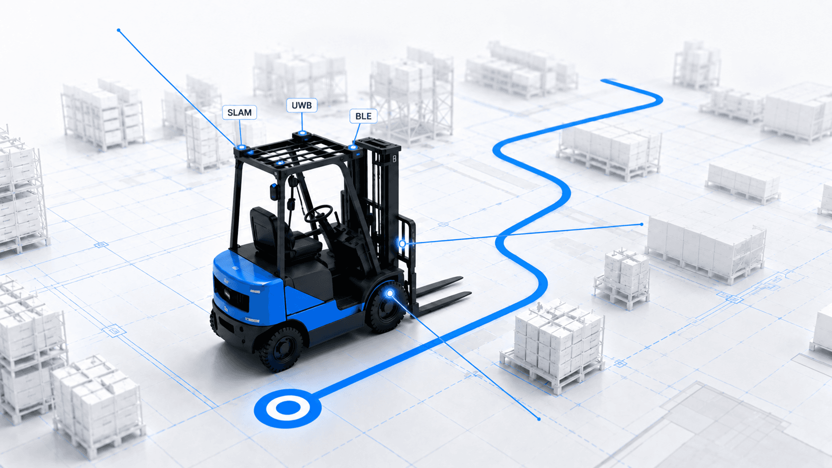
SLAM mounts AI cameras or LiDAR directly onto the forklift. The system reads the floor, surrounding structures, and occasional ceiling references to calculate its own position.4

No wired ceiling grid required. The onboard GPU processes everything in real time, delivering precise X, Y, Z tracking and simultaneous detection of pedestrians and other vehicles. One unit handles both jobs — the positioning radio and the safety camera are no longer two separate line items on two different invoices.

§ 4.2  /  Cost Breakdown

Line itemUnitFigure
Forklift hardware (AI / GPU)per truck$2,000 – $5,000
Facility infrastructure$0 – minimal
Installationper truck$200 – $400
Softwareper truck / month$40 – $100
Year 1 total10 trucks, any size facility$25,000 – $60,000

Real Talk

Strongest return when you need both precision tracking and active pedestrian safety. No ceiling infrastructure means fast deployment and easy scaling. The hardware cost per truck is higher — but you get two systems in one, and skip what would otherwise be a six-figure cabling project.

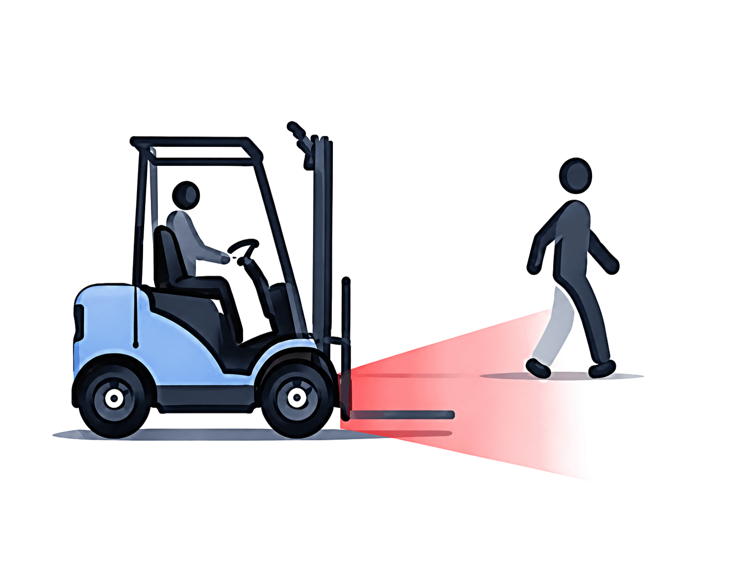
Figure 4.1Onboard SLAM: the truck solves for itself.Camera and LiDAR observe the scene; the GPU fuses features into a live map and a position estimate. The same perception pass feeds pedestrian detection — one device, two deliverables.

Chapter Five · § 5 · Synthesis

Which technology is right for you?

Every facility is different. Use this as a starting point, not a final answer.

TechnologyBest use caseInfrastructureYear 1 cost (10 trucks)
Basic TelematicsOSHA checklists, vehicle healthNone (cellular)$7k – $24k
UWB RangingProximity alerts, open areasNone (peer-to-peer)$16k – $53k
UWB / BLE XYZExact indoor map and trackingExtensive (wired ceiling)$40k – $100k+
SLAM RTLSPrecision tracking + AI safetyMinimal (visual telemetry)$25k – $60k

  SLAM highlighted for strongest return when precision tracking and pedestrian safety are both required.

Colophon · Next Steps

Not sure where to start?

LocaXion guides RTLS projects from first assessment through full deployment — without locking you into a single vendor or technology. Every recommendation is based on your facility, your workflows, and your actual ROI targets.

Book an assessment → Visit locaxion.com

Footnotes

  1. GPS position fix requires line-of-sight to at least four satellites. Inside a steel-framed distribution center, fix reliability degrades to single-digit percent.
  2. Ultra-wideband ranging uses time-of-flight across a very short pulse; typical update rate is 10 – 100 Hz between paired tags.
  3. Installation figures assume union electrician rates in a major US metro; non-union or off-hours rates vary. Software prices are list, not negotiated.
  4. “SLAM” — Simultaneous Localization and Mapping — is a family of algorithms that estimate pose and build a map from the same stream of sensor observations.

LocaXion  Field Guide Vol. I · No. 001 · Forklift Tracking © 2026  /  set in Fraunces & Source Serif 4